I was looking at Google Sattelite images of the Eastern end of the Platte River Trail. It looks like it's been extended. To investigate I took an RTD bus to 88th and Colorado Blvd to Platte River Trailhead Park.

You'll see this sign. Down to the trail and turn left. The trail used to end at 104th ave. I'm going there to see what's new.
Out here the Platte River Trail is pretty rural. I went past horses and other livestock.

I found a spot next to the river for my lunch break. Beautiful scenery.

Here we are at 104th. Hmm, this underpass is new. Used to be you'd cross at street level to dead end across the street.
 What's this? A new bridge followed by a new trail!
 Unfortunately the new trail goes less than a mile but it's a start. You know it will be extended in time.
 OK, here's an old gravel pit being converted into a water reservoir next to this new stretch. There are dozens of these along the Platte. I've seen it done before and documented it on this blog. Go back to 2008 to see two other gravel pits being converted to reservoirs.
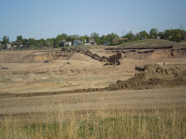 Once it's dug out they'll fill it with water.

End of the line. I called the number on the sign. Adams County: 303-637-8000. I spoke to Roger who told me these pits are indeed being converted to water reservoirs, they're owned by Denver Water, who also own the land past this gate. Denver water is going to allow a bicycle corridor but only after construction. It's gonna be a couple years.


You'll see this sign. Down to the trail and turn left. The trail used to end at 104th ave. I'm going there to see what's new.
Out here the Platte River Trail is pretty rural. I went past horses and other livestock.

I found a spot next to the river for my lunch break. Beautiful scenery.

Here we are at 104th. Hmm, this underpass is new. Used to be you'd cross at street level to dead end across the street.


End of the line. I called the number on the sign. Adams County: 303-637-8000. I spoke to Roger who told me these pits are indeed being converted to water reservoirs, they're owned by Denver Water, who also own the land past this gate. Denver water is going to allow a bicycle corridor but only after construction. It's gonna be a couple years.

View Larger Map
You can see on the map all the water storage reservoirs along the Platte.
Most of these reservoirs allow fishing. I saw some Carp swimming along the surface, poking their noses out of the water every now and then. I don't think I'd eat one but they were huge, 16 inches!
Also new at 104th street is a big park with two lakes featuring dirt trails.


Big healthy tree.


Here is fishing access.

There are rules of course.

I saw a Beaver lodge on the left there. Using my zoom it's hard to center the picture.

Good Bird watching along this part of the Platte.

Nice benches for birders to sit on.

Then you come upon deck seven.

A green deck near Duck habitat.


Good ol' deck seven.


Runoff from an irrigated field.

Turn left here to stay on the Platte. The curvy trail ahead is the Clear Creek Trail that leads to Golden.


Over the bridge to Confluence Park.

A few years ago vandals damaged these rest rooms. They are open again.

They really built that bridge fast. The new one has round legs, the old one has rectangular legs.


In the distance the bridge over Clear Creek and Clear Creek emptying into the Platte.

That's the bridge over the Platte. Picture taken from the slab.

The stairs down to the slab.

The Slab. Good place to chill.
Here's how it looks from the top of the stairs.

Here's the new bridge construction zone..

The New Bridge
 The old bridge which now contains construction equipment.
Here's a look at Denver in the distance. In the foreground you can see one of the reservoirs built in 2008 and documented on this blog.

This is a bad picture but right in the center there is a wild turkey


Here's a shot looking up Sand Creek. It's got high levels of Benzine leaking into it.. Both Aurora and Thornton use the water just downstream from here for drinking. Below you can see the pump and sprayer designed to disperse the benzine into the atmosphere but it was turned off today. Good thing, I use the atmosphere every day and I don't like Benzine. Actually according to the Denver Post May 2, 2012 the Colorado Department Of Public Health and State regulators on April 24th. Benzine concentration in Sand Creek have actually gone up.
Very scarry article by Bruce Finley:


SMILE! You are being watched.


I guess it's prudent to install cameras to prevent crime near such a large project.

The last post has both a fixed camera and (in the bell shaped fixture) a camera that can look around and zoom in on persons of interest. I wondered if taking pictures of these things would result in a visit from a security guard but it didn't. I don't normally linger near this place cause it's kind of stinky.


I was sitting near this nest when I saw a Magpie fly into it. I waited about 5 minutes then got closer for a picture. He saw me and flew away when I was 10 feet away.
Pretty cool nest though, it has a roof and even walls with openings to fly in & out.

This is next to the National Guard HQ. This is where they lowered the Platte 16 feet to ease flood concerns.

Old bridge over the Platte.

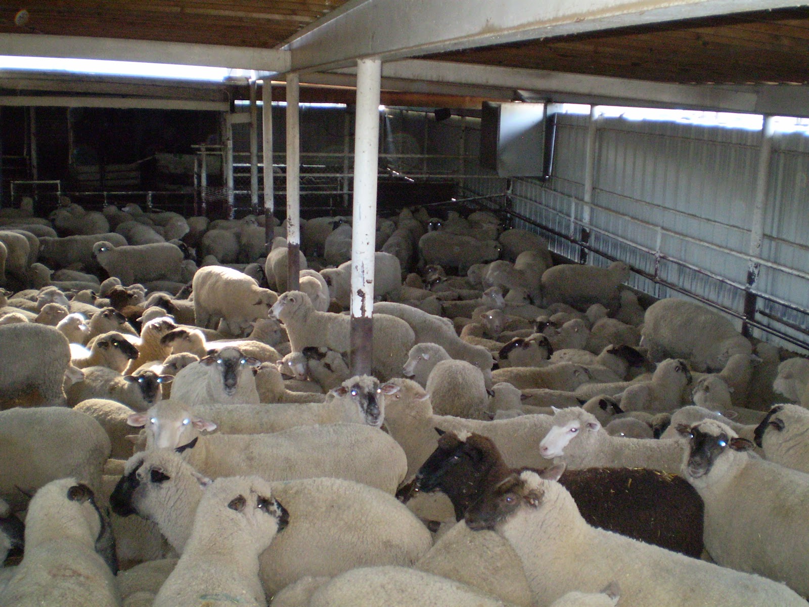
Sheep ready for processing.
Little feral kitty posed for a picture.

There's the refer truck to haul away the sheep after "processing"

Pretty soon the leaves will hide those bird nests.

I went by a BNSF train.

Coming into Denver now.

Beautiful Denver Colorado

The Platte River Trail goes right near the heart of Downtown.

I rode along the South side of the river here.

Then I crossed over to the North side.

People on paddle boats

Good ol' Confluence Park.

There is Cherry Creek meeting the Platte @ Confluence Park.

Ahead the trail is closed if the workers are there but after hours you can get through. There is also a detour.

Here's where the trail ends, you can see the new bridge ahead.

I followed along the train tracks.

It's so nice not to be ashamed of our crappy bridges. Thank you stimulus money. I'd suggest regular maintenance going forward. When you ride Denver's bike paths you see underneath and sometimes it ain't too pretty.

Here's a look up Lakewood Gulch. That trail is officially re-opened and looking good.


Nice mature trees being killed by Beavers. This is near Frog Hollow Park.

As the sun sets on the big silver Dog, my ride is over. Alameda is where I get off. What a great ride.

Almost all my rides get a 4 star rating. It's true though. Denver and surrounding communities really believe in quality bike paths.
THANK YOU COLORADO!
No comments:
Post a Comment