Even though it's not a bike path, it's a highway, and it's nowhere near Denver, it was the epic bike trip of my life. So far.
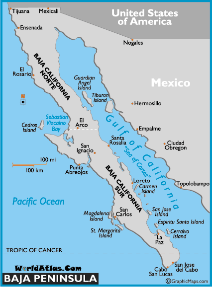
I rode my bike down the Baja Peninsula from Tijuana to La Paz way back in May 1994. About one thousand miles.
I rode an orange Univega on that trip. I still have that bike but it's been retired for 15 years. Baja has been on my mind lately. What a great trip. I recently read the journal I kept on this trip and decided to post it here even though I lost all the pictures I took.
Thank God for the internet. Maps and pics courtesy of public domain.
Let's see, May 1994. Donaldo Colosio, the PRI candidate for el Presidente was campaigning in Tijuana on March 23rd 1994 when he was assassinated. Bummer. All the towns I would ride through still had Colosio banners hanging across the roads. Ernesto Zedillo was eventually elected as the PRI candidate but the PRI would loose it's stranglehold on the Mexican electorate after Zedillo's term. But that story belongs on some other blog, not this one.
 In 1994 there were narco terrorists in Mexico but not on the Baja Peninsula,the Baja was not an acceptable drug route. There were some scary moments on the road with the big trucks, more on that later.


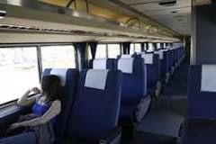
OK, so I took the morning train from Seattle on May 6, 1994. Everyone told me I was crazy and would probably die on this trip. I thought nothing of the sort. I'd been practicing by riding the hill down to the lighthouse at Discovery Park and back up for a year. I was ready.
Sights from the train: May 6th At 6:06 PM I saw a cool red & white covered bridge just North of Oakridge Oregon.

South of Oakridge we went through a second growth forest of Hemlock, Cedar, Magnolia, Pine, Spruce, Fir and more. Wow it's nice to see such diversity. Not far South of that we could see across the valley where a whole hillside had been clear cut and much erosion had taken place.
Jeez, just when I was thinking what good stewards of the land Oregonians were. That second growth forest was spawned during the Roosevelt Administration. The clear cut had taken place very recently.
So maybe this forest mismanagement is a recent occurrence?
Had dinner that night with a woman from Pasco, Wash. Now we were in the Siskiyou mountains of California. I spotted a hobo on a freight train going the other way. she told me when she was a girl in Kansas her father used to "ride the rails" to go see concerts at The Grand Ole Oprey (which was new at the time).

My other dining friend that night was from Cranston B.C. She was on a "Mystery Tour" where their mode of transportation and destination were unknown to the participants beforehand.
Seemed eerily reminiscent of the German mystery railroad trips back in the 1940's. I tried to make a joke but failed. Some things just aren't funny.
May 7th Woke up, got some coffee and all of a sudden the train stopped. We were in the town of Gilroy but Gilroy was not a stop. I looked out the window on the left and there was a deceased man next to the tracks. Blunt force trauma from the train killed him. I got to see what I might look like if I wasn't careful. Not pretty at all. The train was delayed a long time and once behind schedule the train loses it's right of way.

We stopped at Paso Robels to pick up a bunch of people in period dress to celebrate the opening of Cuesta Pass rail line May 5th 1894, 100 years ago. Prior to this segment being opened, Freight Trains would transfer their cargo to ships at San Luis Obispo, go around the obstruction and unload back onto a train in Santa Barbara.
The 110 mile Cuesta Pass segment was built by the big four, C.P. Hunnington, Charles Crocker, Leland Stanford & Mark Hopkins. They also built the Union Pacific Railroad.
I counted 4 tunnels, 2 bridges and 3 deer. When we got to Santa Barbara the people in period dress got off and boarded a steam train that would follow us into Los Angeles.
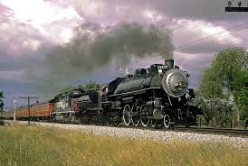
A lot of people with cameras focused in on us so they'd be ready when the steam locomotive rolled through.
L.A. is the end of the line for the Amtrak Coast Starlight. I took the San Diegan to San Diego.
Now days it's called the Pacific Surfliner.
May 8th 1:15 AM, I get to San Diego. I reassemble my bike and get to the Hotel San Diego, room for $41.61

I didn't need luxury I needed sleep. Upon telling the desk clerk of my quest I was asked for the 100th time if I was scared, and for the 100th time I said no, but for the first time I started wondering if I should be. Hey too late now, it was doom or glory now.

May 8th 10:00 AM, I board the trolley for San Ysidro, the border town next to Tijuana. On my bike I crossed the border easily, border guards all smiling and waving. I wanted to get through Tijuana as soon as possible.

Once across the border I head West, that's where highway one is. That's the road I will take South. Then I am at a crossroads. A toll road near the ocean with flat terrain or the twisty mountain road. Both called Highway one. What the heck, the toll road seemed like the obvious choice so I rode downhill a mile to the first toll booth.
There the toll collector told me no bikes on the toll road. I said they should have put a sign saying no bikes a mile up the hill where I came from. So I head back up the hill to the junction and take the twisty mountain road. I went up for 9 kilometers then downhill for a good long time. I make it to Rosarito and get lunch and a buzz cut at the local barber. No common language so I guided her hand with the clippers over my head and she said, "oh glasse", yes, smooth as glass. Enough stubble to resist sunburn. Then I looked for a place to spend the night. Stayed at an RV park in Rosarito.

RV parks are good because the have showers and laundry facilities, not to mention old folks to talk to and swap stories. Many nights I would pitch my tent along side the highway, far enough back to be hidden from view. But my first night in Mexico was in a safe secure spot. I brought a radio/cassette player with me but brought no cassette tapes because of the weight. I listened to two ball games that night, Dodgers v Astros and Padres v Reds, all in Spanish. I listened to a lot of ball games on that trip. Padre is pronounced Padre in Spanish. The Milwaukee Brewers? The Cervasarios! Total distance that day: 49.5 miles

May 9th: Woke up at 5:00 AM with the roosters. The night before I was asleep by 9:30 PM. Living outdoors you soon revert to a natural rhythm. Headed South out of Rosarito on Highway one. Hella mountains today, I learned to siesta today. Find a bush to hide under from 10:00 AM to 2:00 PM to avoid the heat of the day, a practice I would employ every day going forward. Made it to Encinada.
Hung out on the beach. No place to camp, got a motel room. Made 55.2 miles today.
May 10th: 8:40 AM Late start, hey I stayed in a motel, it happens. There was a partial eclipse today, about half the sun was obscured at one point. It felt cooler. I remember I took a break by a huge saguaro cactus and took a picture of my bike leaning against it.

I took eleven rolls of film on my trip. After getting them developed (at great expense) I put them in a Guatemalan bag and they were stolen from my car. No pictures or negatives remain.
I stopped for lunch at a cantina, run by Jeff, an American from Eugene Oregon.

Jeff told me I can drink the Baja water with no fear. He told me every so often there are big spigots next to the road surrounded by a chain link fence. The gates are unlocked and you go inside and fill your water bottles, then shower in the gush of pure water. I made a habit of stopping at every one, usually a couple miles apart. It was the ultimate cool down in the Mexican heat.

I rode mountains today, stopped just South of Santo Tomas, far enough from the highway so I couldn't be seen. Pitched my tent in a field with two horses.

They seem friendly. Rode 60.8 miles today.
May 11th: Woke up with the sun.
There was this giant bumble bee observing me through the screen on my tent. I tried telepathy to get him to maneuver for me with mixed results. The horses were gone and two long horn steer were next to my tent. I packed up & got going at 6:10 AM.

The goal was San Quentin, made it well past there, pitched my tent off the highway. Made 78.2 miles today.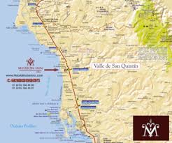
May 12th: Got going at 6:30 AM except for siesta I rode from sun up to dusk. A lot of mountains today. Camped off the road near Catavina.

I learned one thing when I saw a big truck coming. Get off my bike and stand on the other side of the guard rail. The reason was because in Mexico the roads are almost wide enough for two eighteen wheelers to pass one another but not quite, requiring oncoming trucks to both veer onto the shoulder to pass safely.
Therefore if I saw a truck coming and I couldn't be sure if one was approaching from behind I'd jump over the guard rail or otherwise away from the shoulder. If a truck driver had a choice of hitting a person on a bike or a head on collision with another truck what do you think he'd do?
Fortunately truck traffic was light because the Baja is a dead end. Trucks on the Baja were mostly supplying the Baja. Ferry fare for a big truck to the mainland at La Paz is mucho dinero, not much traffic. The ferry was full of trucks, but it only sailed once a day.
Oh and the guard rails in Mexico are held in place by pea gravel. Once I leaned my bike on a guardrail and it fell over. In America the posts are buried for stability, to keep cars from going off the road. In Mexico a missing guard rail encourages law enforcement to look over the cliff to see the wreck. Many religious shrines have been erected in honor of those who have died on this dangerous highway.
Some simple, some elaborate, very numerous and the candles were always lit.


I knew if I were to be harmed on the trip, it would be on the highway. These stark reminders made me cautious.
Made 63.4 miles today.
May 13th: Got started early, 6:00 AM, had lunch at a cantina by the road. It had four lovely walls but no roof. I bet biz drops off in the rainy season. Pitched tent at 6:30 PM near Chapala. I ate at random places along the road mostly, but I always had a supply of dried fruit with me to give me energy between cantinas.

Should be in Punta Prieta early tomorrow. made 68.9 miles today.
May 14th: Got started early. Blew past Punta Prieta on flat terrain to Gurrero Negro on the Pacific coast,
the border between Baja California and Baja California Sur.
Baja California Sur is in the Mountain Time Zone not the Pacific Time Zone. Weird. You're on the Pacific Ocean but you're in the Mountain Time Zone.
Got a room at the La Pinta, swimming pool, laundry and a real bed. Watched The Terminator on the TV in my room. Dubbed in Spanish. OK, remember the last scene in the movie, where Sarah Connor is buying gasoline down in Mexico, and she has to use a Spanish phrase book to order the gasoline in broken Spanish? In the Mexican version she speaks impeccable Spanish, phrase book or no.
111.3 miles today. Woo hoo!
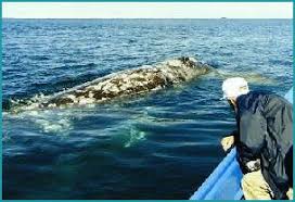
Gurrero Negro's claim to fame is salt and humpback whales. They evaporate salt water to make salt

And Humpbacks come here to give birth to their babies and hang out for the winter.
I bought a Creedence Clearwater and a Beatles cassette tape in Gurerro Negro because I was in very remote territory and radio reception was sketchy. Creedence is huge in Mexico.
May 15th: One week on the road, feeling great. Heading towards San Ignacio. First flat tire yesterday, bad patch, had to re pump this morning. Camped by the road near a truck stop to be near a shower. Played soccer with a group of kids tonight.
Made 55 miles today.

That ain't me but that's the Baja Highway one for sure. I'd have a helmet on.
May 16th: Long ride today, the road goes from Gurrero Negro on the Pacific coast to Santa Rosalia on the Sea Of Cortez.

San Ignatio is about the halfway point. Pretty flat until 20 miles from San Ignacio. Then some good climbing. I camped outside of town.
I made 47.8 miles today.
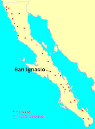
May 17th 7:45 AM Eating Mexican Omelette in San Ignacio. Wow, this town has electricity and flush toilets. Luxury. Even a standing Mission.
In Seattle near my house back then is a little store called The Wicker Basket. I used to buy baseball cards there. Real nice immigrant fellow with limited English skills ran the place. One day we had a big snowstorm and I walked down to buy some cards. "some snowstorm, eh?" I said. He answered "Yes!" I made three or four statements about the storm and he answered "yes!" each time. Then I said "oh your hair is on fire" and he answered "yes!" once again.
Fast forward to this Omelette I'm ordering. I can't converse in Spanish but I can order food. So I had made my order and he asked me a few questions I couldn't understand so I just said "Si" each time When I said Si to the last question everyone in the Cantina laughed. Whose hair was on fire now?
Stopped for lunch at Mezquital, about halfway between San Ignacio and Santa Rosalia, my next stop.
This person is gliding the downslope towards Santa Rosalia. See how the shoulder has a wide white line? That's what the trucks use when passing one another.

When I reached the sea of Cortez, North of Santa Rosalia, I stripped naked and walked on the smooth stones into the warm water. It was really nice. Totally secluded beach. For me it was a rite of passage. I've crossed from the Pacific to the Sea Of Cortez. Good for me.
Stayed at el Tecote campground in Santa Rosalia.

Played dice with some World War Two Veterans that night. They told me of a great RV park in Mulege. Made 53.2 miles today.
May 18th: Long ride, beautiful scenery along the coast today. started at 6:30 and rode till I made it to Mulege* on the coast @ 5 PM. Stayed at The Orchard RV Park. Sat up drinking with some oldsters. One of them confessed to me he shot his Sargent in Korea. When I asked why he said "because he was a son of a bitch". OK, note to self, don't piss this guy off. 46.4 miles today.
*pronounced moo lah hay
May 19th: In the morning as I left the R.V. park I saw an old broken down Tractor. The ornate grill on the front said Buffalo Springfield in cursive script. After I returned from my trip I researched the Buffalo Springfield company. They made road building and farm equipment and during the build out of the nations interstate highway system Buffalo Springfield was at their pinnacle.

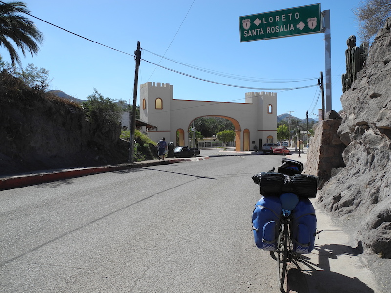
Not to mention the inspiration for the name of a band Neil Young & Stephen Stills were in. I wanted that grill but being on a bike means no souvenirs. Especially no 50 pound ones. I rode all the way to Loretto that day where I booked a room in a hotel. Showers and clean laundry, YAY!
Loretto is the oldest city in the Three Californias. (California, Baja California & Baja California Sur).
The Catholic church had built Missions all down the Baja, each spaced about a day's horseback ride apart. Turns out a horse and a bike travel about the same, but up until now most of the Missions have been ruins. I checked out the Mission in Loretto. Hey, Jesus was a Mexican. Who knew? At least according to the artwork inside.
Loretto was civilized by a German missionary family named Davis. They had blonde hair & blue eyes. I was having a beer at a cantina when I turned to what I assumed was a tanned American surfer dude to talk but this blue eyed blonde haired Mexican was a Davis descendant! Amazing. 70 miles today.
May 20th: Took a day off in Loretto. Really nice town, old old buildings, great beach. Heck this is a vacation after all. I made an extensive study of the Mission and grounds surrounding it.
This is the spiral staircase in the Chapel at Loretto.
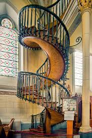
The Mission

May 21st: OK just South of Loretto the highway crosses the mountains back to the Pacific Ocean again. The mountains were called the Sierra Giganta.

OK, I got no Spanish skills but I know that means giant mountains. I decided the next segment would be by bus. The pass ahead was steep and dangerous. I took the bus from Loretto to Ciudad Constitucion. A hundred miles maybe. The fare for me & bike was $6.00.

At the bus station I attempted to call my mom, who was worried. Couldn't reach mom so I called my Aunt Pat to relay the message I was alive & well.
Headed South after that, had lunch in teeny tiny Santa Rita. Don't let the map below fool you. Santa Rita is teeny tiny and La Paz is huge. This map must be courtesy of the Santa Rita chamber of commerce...

There were no restaurants in Santa Rita there was a torta booth getting ready for the festival, which was going to happen the next day. The people were already celebrating and warmly welcomed me. I asked what Festival is it? Festival de Santa Rita! Wow.
Hey why doesn't Denver have a Patron Saint when this little punk ass town does? Santa Rita doesn't even show up on google maps, which I am using as a reference. Hey, it's been @ 20 years since I took this trip.
After that I rode South until dusk, then found a hidden tent site. Riding miles today: 77.3 Bus miles @ 100. The mountain pass was only 40 miles or so but I couldn't get off until the next stop.
Taking the bus shaved one or two days off the trip and may have saved my life. I looked out the windows going over that pass and I was surprised we made it. That was a gnarly road.
May 22nd: Today is the day I reach La Paz. Wow. Not dead. Not yet anyway. There was a fair amount of climbing in the morning, as I was headed to the Sea Of Cortez from the Pacific Ocean once again. Of course the climbing paid off with a 12 mile descent into La Paz. Much of it with my hands off the handlebars and pumping up and down in a celebratory fashion.
I did it. I have ridden the Baja. Now for the relaxation phase of the trip. 41.5 miles today. Arrived La Paz at 4:00 PM. I found an RV park and pitched my tent. Two weeks, 1,000 miles, I felt great. I showered and then did something I hadn't done in two weeks, I went downtown. Having been in the sun for two weeks I had a dark tan. I looked like a local.

That evening when I tried to go into the local disco I was denied entry. They told me why but I couldn't understand then a person told me "they're saying you're too old". Holy crap, too old? At the time I was 36 years old. Oh well, put me out to pasture, even though I just conquered the Baja! So I hung in La Paz for a couple of days.
Then I bought a ticket on the ferry from La Paz to Mazatlan.

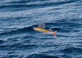
It was awesome. I paid $16 for a private room with a porthole to see outside. I saw flying fish for the first time (and only so far), saw dolphins too. It seems most of the ticket price is based on your vehicle size and a bicycle is nothing. Zero. Nada.

The trip lasts overnight and arrives in Mazatlan in the early morning.I had a picture of me wearing the captains hat sitting at the helm on that ship. The pictures were stolen as I mentioned before. Bummer. On the ship there was a disco and another bar. Hadn't participated in much night life lately but what the heck, I'm on vacation. This time I gained admission to the disco.

Mazatlan had some history for me. When I was 16 my family spent Christmas in Mazatlan. So now it's 20 years later. The Playa Del Ray (our hotel) was still there but it had a new name, I went there and reimagined that long ago Christmas.
I went to the RV park to camp and noticed an RV with Washington state licence plates and met Himi. Himi was a local celebrity as far as I could tell, and was warmly greeted by many people as we walked through town. I accompanied Himi and several other Americans to a secret beach one day. It was awesome. Just us, white sand, perfect.
May 27th:
I'm staying at the Posta RV park in Mazatlan.

Haven't written in five days. I've been busy being a tourist.
May 28th:
Himi led a small group up El Farro, where there is a lighthouse.

At the bottom of the trail we saw the beer drinking, cigarette smoking monkey in a cage. If you have to live in a cage, at least there's beer, which most caged animals don't get. As for cigarettes, well I'm against those.

June 1st:
Waiting for train from Mazatlan to Mexicali.

One dude walked over to me and asked if I was American. I said yes. He said his compadre swore I was a Mexican. We hit it off. His name was Jesse. He helped me get back to the USA.
Himi told me to take the local train instead of the express. Better to get the local feel he said. In hindsight this was bad advice. The local train had no air conditioning and stopped every 5 minutes.
At each stop local people would get on selling food and drinks which I dare not buy lest I get sick. They would get off at the next stop then a new group of vendors would board.
I became dismayed by the fact that all the passengers were throwing their garbage out the windows.
I gathered up some refuse in a plastic bag then walked up to the conductor and handed him the garbage and he promptly threw it out the window. OK, so now I know where the garbage can is. Outside the window. What a country!
June 3rd:
Sometime in the night we had to switch trains. I was unprepared for this. By the time I was able to get my bike and my gear off the train and onto the next one there were no seats left. Not uncommon on a Mexican train. So I hung out in the aisles but eventually I met Henry, Johanna & Christina between cars and we drank a Kahlua and tequila concoction late into the night.
That is where I believe I got Montezuma's revenge. The ice in the drink we passed around must have been contaminated. Of course I didn't get sick for a couple days. The train ride ended in Mexicali Mexico and I crossed into Calexico California. From there I had to get back to San Diego for the train ride back to Seattle.
June 5th
Greyhound Bus Lines would accept a bike only if it's in a cardboard enclosure. I had to fish cardboard boxes out of dumpsters to fashion a custom cardboard box but had it ready in time for the trip. Took the bus to San Diego on June 5th 1994. One day before the D Day 50th anniversary. Watched the tributes on TV in my hotel room that night.
June 6th
I went to Tijuana to experience the tourist thing. I bought lots of crap.
Got back to the room deathly ill. Projectile vomiting out both ends, nasty business. My own personal "D" Day.

June 7th:
Made it to the train, very ill, sick all the way back to Seattle.

Montezuma had his revenge for about a week after I got home, longer than I would have thought. Then I got better.
What a great trip. I proved everyone wrong although the diarrhea nearly killed me.
I searched you tube for some footage to give you the idea of the trip. This was close to my experience but I encountered no other bikers.
I rode my bike down the Baja Peninsula from Tijuana to La Paz way back in May 1994. About one thousand miles.
I rode an orange Univega on that trip. I still have that bike but it's been retired for 15 years. Baja has been on my mind lately. What a great trip. I recently read the journal I kept on this trip and decided to post it here even though I lost all the pictures I took.
Thank God for the internet. Maps and pics courtesy of public domain.
Let's see, May 1994. Donaldo Colosio, the PRI candidate for el Presidente was campaigning in Tijuana on March 23rd 1994 when he was assassinated. Bummer. All the towns I would ride through still had Colosio banners hanging across the roads. Ernesto Zedillo was eventually elected as the PRI candidate but the PRI would loose it's stranglehold on the Mexican electorate after Zedillo's term. But that story belongs on some other blog, not this one.

OK, so I took the morning train from Seattle on May 6, 1994. Everyone told me I was crazy and would probably die on this trip. I thought nothing of the sort. I'd been practicing by riding the hill down to the lighthouse at Discovery Park and back up for a year. I was ready.
Sights from the train: May 6th At 6:06 PM I saw a cool red & white covered bridge just North of Oakridge Oregon.
South of Oakridge we went through a second growth forest of Hemlock, Cedar, Magnolia, Pine, Spruce, Fir and more. Wow it's nice to see such diversity. Not far South of that we could see across the valley where a whole hillside had been clear cut and much erosion had taken place.
Jeez, just when I was thinking what good stewards of the land Oregonians were. That second growth forest was spawned during the Roosevelt Administration. The clear cut had taken place very recently.
So maybe this forest mismanagement is a recent occurrence?
Had dinner that night with a woman from Pasco, Wash. Now we were in the Siskiyou mountains of California. I spotted a hobo on a freight train going the other way. she told me when she was a girl in Kansas her father used to "ride the rails" to go see concerts at The Grand Ole Oprey (which was new at the time).
My other dining friend that night was from Cranston B.C. She was on a "Mystery Tour" where their mode of transportation and destination were unknown to the participants beforehand.
Seemed eerily reminiscent of the German mystery railroad trips back in the 1940's. I tried to make a joke but failed. Some things just aren't funny.
May 7th Woke up, got some coffee and all of a sudden the train stopped. We were in the town of Gilroy but Gilroy was not a stop. I looked out the window on the left and there was a deceased man next to the tracks. Blunt force trauma from the train killed him. I got to see what I might look like if I wasn't careful. Not pretty at all. The train was delayed a long time and once behind schedule the train loses it's right of way.
We stopped at Paso Robels to pick up a bunch of people in period dress to celebrate the opening of Cuesta Pass rail line May 5th 1894, 100 years ago. Prior to this segment being opened, Freight Trains would transfer their cargo to ships at San Luis Obispo, go around the obstruction and unload back onto a train in Santa Barbara.
The 110 mile Cuesta Pass segment was built by the big four, C.P. Hunnington, Charles Crocker, Leland Stanford & Mark Hopkins. They also built the Union Pacific Railroad.
I counted 4 tunnels, 2 bridges and 3 deer. When we got to Santa Barbara the people in period dress got off and boarded a steam train that would follow us into Los Angeles.
A lot of people with cameras focused in on us so they'd be ready when the steam locomotive rolled through.
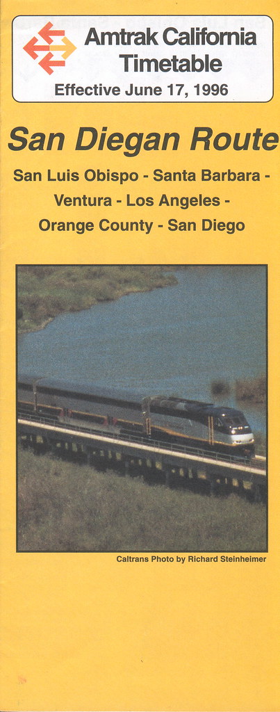
L.A. is the end of the line for the Amtrak Coast Starlight. I took the San Diegan to San Diego.
Now days it's called the Pacific Surfliner.
May 8th 1:15 AM, I get to San Diego. I reassemble my bike and get to the Hotel San Diego, room for $41.61
I didn't need luxury I needed sleep. Upon telling the desk clerk of my quest I was asked for the 100th time if I was scared, and for the 100th time I said no, but for the first time I started wondering if I should be. Hey too late now, it was doom or glory now.
May 8th 10:00 AM, I board the trolley for San Ysidro, the border town next to Tijuana. On my bike I crossed the border easily, border guards all smiling and waving. I wanted to get through Tijuana as soon as possible.
Once across the border I head West, that's where highway one is. That's the road I will take South. Then I am at a crossroads. A toll road near the ocean with flat terrain or the twisty mountain road. Both called Highway one. What the heck, the toll road seemed like the obvious choice so I rode downhill a mile to the first toll booth.
There the toll collector told me no bikes on the toll road. I said they should have put a sign saying no bikes a mile up the hill where I came from. So I head back up the hill to the junction and take the twisty mountain road. I went up for 9 kilometers then downhill for a good long time. I make it to Rosarito and get lunch and a buzz cut at the local barber. No common language so I guided her hand with the clippers over my head and she said, "oh glasse", yes, smooth as glass. Enough stubble to resist sunburn. Then I looked for a place to spend the night. Stayed at an RV park in Rosarito.
RV parks are good because the have showers and laundry facilities, not to mention old folks to talk to and swap stories. Many nights I would pitch my tent along side the highway, far enough back to be hidden from view. But my first night in Mexico was in a safe secure spot. I brought a radio/cassette player with me but brought no cassette tapes because of the weight. I listened to two ball games that night, Dodgers v Astros and Padres v Reds, all in Spanish. I listened to a lot of ball games on that trip. Padre is pronounced Padre in Spanish. The Milwaukee Brewers? The Cervasarios! Total distance that day: 49.5 miles
May 9th: Woke up at 5:00 AM with the roosters. The night before I was asleep by 9:30 PM. Living outdoors you soon revert to a natural rhythm. Headed South out of Rosarito on Highway one. Hella mountains today, I learned to siesta today. Find a bush to hide under from 10:00 AM to 2:00 PM to avoid the heat of the day, a practice I would employ every day going forward. Made it to Encinada.
Hung out on the beach. No place to camp, got a motel room. Made 55.2 miles today.
May 10th: 8:40 AM Late start, hey I stayed in a motel, it happens. There was a partial eclipse today, about half the sun was obscured at one point. It felt cooler. I remember I took a break by a huge saguaro cactus and took a picture of my bike leaning against it.
I took eleven rolls of film on my trip. After getting them developed (at great expense) I put them in a Guatemalan bag and they were stolen from my car. No pictures or negatives remain.
I stopped for lunch at a cantina, run by Jeff, an American from Eugene Oregon.
Jeff told me I can drink the Baja water with no fear. He told me every so often there are big spigots next to the road surrounded by a chain link fence. The gates are unlocked and you go inside and fill your water bottles, then shower in the gush of pure water. I made a habit of stopping at every one, usually a couple miles apart. It was the ultimate cool down in the Mexican heat.
I rode mountains today, stopped just South of Santo Tomas, far enough from the highway so I couldn't be seen. Pitched my tent in a field with two horses.
They seem friendly. Rode 60.8 miles today.
May 11th: Woke up with the sun.
There was this giant bumble bee observing me through the screen on my tent. I tried telepathy to get him to maneuver for me with mixed results. The horses were gone and two long horn steer were next to my tent. I packed up & got going at 6:10 AM.
The goal was San Quentin, made it well past there, pitched my tent off the highway. Made 78.2 miles today.
May 12th: Got going at 6:30 AM except for siesta I rode from sun up to dusk. A lot of mountains today. Camped off the road near Catavina.
I learned one thing when I saw a big truck coming. Get off my bike and stand on the other side of the guard rail. The reason was because in Mexico the roads are almost wide enough for two eighteen wheelers to pass one another but not quite, requiring oncoming trucks to both veer onto the shoulder to pass safely.
Therefore if I saw a truck coming and I couldn't be sure if one was approaching from behind I'd jump over the guard rail or otherwise away from the shoulder. If a truck driver had a choice of hitting a person on a bike or a head on collision with another truck what do you think he'd do?
Fortunately truck traffic was light because the Baja is a dead end. Trucks on the Baja were mostly supplying the Baja. Ferry fare for a big truck to the mainland at La Paz is mucho dinero, not much traffic. The ferry was full of trucks, but it only sailed once a day.
Oh and the guard rails in Mexico are held in place by pea gravel. Once I leaned my bike on a guardrail and it fell over. In America the posts are buried for stability, to keep cars from going off the road. In Mexico a missing guard rail encourages law enforcement to look over the cliff to see the wreck. Many religious shrines have been erected in honor of those who have died on this dangerous highway.
Some simple, some elaborate, very numerous and the candles were always lit.
I knew if I were to be harmed on the trip, it would be on the highway. These stark reminders made me cautious.
Made 63.4 miles today.
May 13th: Got started early, 6:00 AM, had lunch at a cantina by the road. It had four lovely walls but no roof. I bet biz drops off in the rainy season. Pitched tent at 6:30 PM near Chapala. I ate at random places along the road mostly, but I always had a supply of dried fruit with me to give me energy between cantinas.
Should be in Punta Prieta early tomorrow. made 68.9 miles today.
May 14th: Got started early. Blew past Punta Prieta on flat terrain to Gurrero Negro on the Pacific coast,
the border between Baja California and Baja California Sur.
Baja California Sur is in the Mountain Time Zone not the Pacific Time Zone. Weird. You're on the Pacific Ocean but you're in the Mountain Time Zone.
Got a room at the La Pinta, swimming pool, laundry and a real bed. Watched The Terminator on the TV in my room. Dubbed in Spanish. OK, remember the last scene in the movie, where Sarah Connor is buying gasoline down in Mexico, and she has to use a Spanish phrase book to order the gasoline in broken Spanish? In the Mexican version she speaks impeccable Spanish, phrase book or no.
111.3 miles today. Woo hoo!
Gurrero Negro's claim to fame is salt and humpback whales. They evaporate salt water to make salt
And Humpbacks come here to give birth to their babies and hang out for the winter.
I bought a Creedence Clearwater and a Beatles cassette tape in Gurerro Negro because I was in very remote territory and radio reception was sketchy. Creedence is huge in Mexico.
May 15th: One week on the road, feeling great. Heading towards San Ignacio. First flat tire yesterday, bad patch, had to re pump this morning. Camped by the road near a truck stop to be near a shower. Played soccer with a group of kids tonight.
Made 55 miles today.
That ain't me but that's the Baja Highway one for sure. I'd have a helmet on.
May 16th: Long ride today, the road goes from Gurrero Negro on the Pacific coast to Santa Rosalia on the Sea Of Cortez.
San Ignatio is about the halfway point. Pretty flat until 20 miles from San Ignacio. Then some good climbing. I camped outside of town.
I made 47.8 miles today.
May 17th 7:45 AM Eating Mexican Omelette in San Ignacio. Wow, this town has electricity and flush toilets. Luxury. Even a standing Mission.
In Seattle near my house back then is a little store called The Wicker Basket. I used to buy baseball cards there. Real nice immigrant fellow with limited English skills ran the place. One day we had a big snowstorm and I walked down to buy some cards. "some snowstorm, eh?" I said. He answered "Yes!" I made three or four statements about the storm and he answered "yes!" each time. Then I said "oh your hair is on fire" and he answered "yes!" once again.
Fast forward to this Omelette I'm ordering. I can't converse in Spanish but I can order food. So I had made my order and he asked me a few questions I couldn't understand so I just said "Si" each time When I said Si to the last question everyone in the Cantina laughed. Whose hair was on fire now?
Stopped for lunch at Mezquital, about halfway between San Ignacio and Santa Rosalia, my next stop.
This person is gliding the downslope towards Santa Rosalia. See how the shoulder has a wide white line? That's what the trucks use when passing one another.
When I reached the sea of Cortez, North of Santa Rosalia, I stripped naked and walked on the smooth stones into the warm water. It was really nice. Totally secluded beach. For me it was a rite of passage. I've crossed from the Pacific to the Sea Of Cortez. Good for me.
Stayed at el Tecote campground in Santa Rosalia.
Played dice with some World War Two Veterans that night. They told me of a great RV park in Mulege. Made 53.2 miles today.
May 18th: Long ride, beautiful scenery along the coast today. started at 6:30 and rode till I made it to Mulege* on the coast @ 5 PM. Stayed at The Orchard RV Park. Sat up drinking with some oldsters. One of them confessed to me he shot his Sargent in Korea. When I asked why he said "because he was a son of a bitch". OK, note to self, don't piss this guy off. 46.4 miles today.
*pronounced moo lah hay
May 19th: In the morning as I left the R.V. park I saw an old broken down Tractor. The ornate grill on the front said Buffalo Springfield in cursive script. After I returned from my trip I researched the Buffalo Springfield company. They made road building and farm equipment and during the build out of the nations interstate highway system Buffalo Springfield was at their pinnacle.
Not to mention the inspiration for the name of a band Neil Young & Stephen Stills were in. I wanted that grill but being on a bike means no souvenirs. Especially no 50 pound ones. I rode all the way to Loretto that day where I booked a room in a hotel. Showers and clean laundry, YAY!
Loretto is the oldest city in the Three Californias. (California, Baja California & Baja California Sur).
The Catholic church had built Missions all down the Baja, each spaced about a day's horseback ride apart. Turns out a horse and a bike travel about the same, but up until now most of the Missions have been ruins. I checked out the Mission in Loretto. Hey, Jesus was a Mexican. Who knew? At least according to the artwork inside.
Loretto was civilized by a German missionary family named Davis. They had blonde hair & blue eyes. I was having a beer at a cantina when I turned to what I assumed was a tanned American surfer dude to talk but this blue eyed blonde haired Mexican was a Davis descendant! Amazing. 70 miles today.
May 20th: Took a day off in Loretto. Really nice town, old old buildings, great beach. Heck this is a vacation after all. I made an extensive study of the Mission and grounds surrounding it.
This is the spiral staircase in the Chapel at Loretto.
The Mission
May 21st: OK just South of Loretto the highway crosses the mountains back to the Pacific Ocean again. The mountains were called the Sierra Giganta.
OK, I got no Spanish skills but I know that means giant mountains. I decided the next segment would be by bus. The pass ahead was steep and dangerous. I took the bus from Loretto to Ciudad Constitucion. A hundred miles maybe. The fare for me & bike was $6.00.
At the bus station I attempted to call my mom, who was worried. Couldn't reach mom so I called my Aunt Pat to relay the message I was alive & well.
Headed South after that, had lunch in teeny tiny Santa Rita. Don't let the map below fool you. Santa Rita is teeny tiny and La Paz is huge. This map must be courtesy of the Santa Rita chamber of commerce...
There were no restaurants in Santa Rita there was a torta booth getting ready for the festival, which was going to happen the next day. The people were already celebrating and warmly welcomed me. I asked what Festival is it? Festival de Santa Rita! Wow.
Hey why doesn't Denver have a Patron Saint when this little punk ass town does? Santa Rita doesn't even show up on google maps, which I am using as a reference. Hey, it's been @ 20 years since I took this trip.
After that I rode South until dusk, then found a hidden tent site. Riding miles today: 77.3 Bus miles @ 100. The mountain pass was only 40 miles or so but I couldn't get off until the next stop.
Taking the bus shaved one or two days off the trip and may have saved my life. I looked out the windows going over that pass and I was surprised we made it. That was a gnarly road.
May 22nd: Today is the day I reach La Paz. Wow. Not dead. Not yet anyway. There was a fair amount of climbing in the morning, as I was headed to the Sea Of Cortez from the Pacific Ocean once again. Of course the climbing paid off with a 12 mile descent into La Paz. Much of it with my hands off the handlebars and pumping up and down in a celebratory fashion.
I did it. I have ridden the Baja. Now for the relaxation phase of the trip. 41.5 miles today. Arrived La Paz at 4:00 PM. I found an RV park and pitched my tent. Two weeks, 1,000 miles, I felt great. I showered and then did something I hadn't done in two weeks, I went downtown. Having been in the sun for two weeks I had a dark tan. I looked like a local.
That evening when I tried to go into the local disco I was denied entry. They told me why but I couldn't understand then a person told me "they're saying you're too old". Holy crap, too old? At the time I was 36 years old. Oh well, put me out to pasture, even though I just conquered the Baja! So I hung in La Paz for a couple of days.
Then I bought a ticket on the ferry from La Paz to Mazatlan.
It was awesome. I paid $16 for a private room with a porthole to see outside. I saw flying fish for the first time (and only so far), saw dolphins too. It seems most of the ticket price is based on your vehicle size and a bicycle is nothing. Zero. Nada.
The trip lasts overnight and arrives in Mazatlan in the early morning.I had a picture of me wearing the captains hat sitting at the helm on that ship. The pictures were stolen as I mentioned before. Bummer. On the ship there was a disco and another bar. Hadn't participated in much night life lately but what the heck, I'm on vacation. This time I gained admission to the disco.
Mazatlan had some history for me. When I was 16 my family spent Christmas in Mazatlan. So now it's 20 years later. The Playa Del Ray (our hotel) was still there but it had a new name, I went there and reimagined that long ago Christmas.
I went to the RV park to camp and noticed an RV with Washington state licence plates and met Himi. Himi was a local celebrity as far as I could tell, and was warmly greeted by many people as we walked through town. I accompanied Himi and several other Americans to a secret beach one day. It was awesome. Just us, white sand, perfect.
May 27th:
I'm staying at the Posta RV park in Mazatlan.
Haven't written in five days. I've been busy being a tourist.
May 28th:
Himi led a small group up El Farro, where there is a lighthouse.
At the bottom of the trail we saw the beer drinking, cigarette smoking monkey in a cage. If you have to live in a cage, at least there's beer, which most caged animals don't get. As for cigarettes, well I'm against those.
June 1st:
Waiting for train from Mazatlan to Mexicali.
One dude walked over to me and asked if I was American. I said yes. He said his compadre swore I was a Mexican. We hit it off. His name was Jesse. He helped me get back to the USA.
Himi told me to take the local train instead of the express. Better to get the local feel he said. In hindsight this was bad advice. The local train had no air conditioning and stopped every 5 minutes.
At each stop local people would get on selling food and drinks which I dare not buy lest I get sick. They would get off at the next stop then a new group of vendors would board.
I became dismayed by the fact that all the passengers were throwing their garbage out the windows.
I gathered up some refuse in a plastic bag then walked up to the conductor and handed him the garbage and he promptly threw it out the window. OK, so now I know where the garbage can is. Outside the window. What a country!
June 3rd:
Sometime in the night we had to switch trains. I was unprepared for this. By the time I was able to get my bike and my gear off the train and onto the next one there were no seats left. Not uncommon on a Mexican train. So I hung out in the aisles but eventually I met Henry, Johanna & Christina between cars and we drank a Kahlua and tequila concoction late into the night.
That is where I believe I got Montezuma's revenge. The ice in the drink we passed around must have been contaminated. Of course I didn't get sick for a couple days. The train ride ended in Mexicali Mexico and I crossed into Calexico California. From there I had to get back to San Diego for the train ride back to Seattle.
June 5th
Greyhound Bus Lines would accept a bike only if it's in a cardboard enclosure. I had to fish cardboard boxes out of dumpsters to fashion a custom cardboard box but had it ready in time for the trip. Took the bus to San Diego on June 5th 1994. One day before the D Day 50th anniversary. Watched the tributes on TV in my hotel room that night.
June 6th
I went to Tijuana to experience the tourist thing. I bought lots of crap.
Got back to the room deathly ill. Projectile vomiting out both ends, nasty business. My own personal "D" Day.
June 7th:
Made it to the train, very ill, sick all the way back to Seattle.
Montezuma had his revenge for about a week after I got home, longer than I would have thought. Then I got better.
What a great trip. I proved everyone wrong although the diarrhea nearly killed me.
I searched you tube for some footage to give you the idea of the trip. This was close to my experience but I encountered no other bikers.
This is Encinada to San Ignacio, only a portion of my actual journey.
Just for the record, those bike trailers you'll see didn't exist 20 years ago. I had two rear panniers and my tent and sleeping bag positioned above those. That's it. And in those days the Baja was a lonely place. It looks like it's become much more popular by bike these days. Although I didn't meet even one other bicycle person on my trip I got toto respecto from the motorcyclists. I guess that makes me a pioneer. Good for me.