But that's all changed now. Because Google Maps now include bike paths I bought a smart phone. For years I've been impressed with great apps my friends show me but I never felt inclined to own one until Google did bike paths. They're shown on the map in green. It's awesome.
If I'm ever in doubt I can whip out my Droid, see where I am on a GPS Google satellite map and see all bike path options in green. I'll never be lost again.
So with that in mind I decided to ride Ralston Creek from the top to the bottom.
www.rtd-denver.com
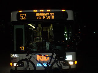
I needed to catch the RTD #52 to W 64th and Virgil Way. Actually one stop past that, W 64th and the Baseball Fields but if you're plotting your own trip Virgil is more helpful than Baseball Fields.
I know the RTD #52 makes only two runs up that far in the morning. I started at the Alameda light rail station, caught the #52 at 5:50 AM. That's the second run.
As I left the house I had second thoughts because it was so cold, 26 degrees, but I had layers enough I decided. And besides the sun would rise soon and warm everything. The RTD #52 winds it's way through North Denver on it's way out to the drop zone. RTD is kind of a cool way to see your city. Busses take routes you wouldn't normally take. It's very scenic, actually. I don't commute to work via public transit but as a recreational resource WWW.RTD-DENVER.COM rules!
Here's the sun rising over the plains.
ACCESS TO THE RESERVOIR IS CLOSED
unless you are on the bike path. That's open.
Arvada open space.
Way up at the top the trail is near Highway 93 from Golden to Boulder.
View Larger Map
Trail goes up and down.
This is the bridge over Ralston Creek. Once known for gold, now known for high uranium content due to seepage from the Swartzwalder mine upstream. OK to ride, don't drink the water though.
P.S. This is a major source of drinking water for local residents.
Sunrise over the Blunn Reservoir.
There's Denver again in the background in the early morning, Blunn Reservoir foreground, Tucker Lake rear left.
Trail winds around Tucker. Bench on which to ponder Tucker Lake.
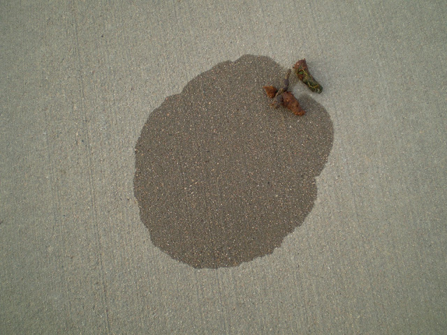
OK I was not going to include any scat pics I found two apparent defecation and urination sites caught before the sun evaporated the urine. So due to the proximity I'd say they are from females.
These are pics of the first wet scat.
After you round Tucker Lake you reach a fork. Either way will lead to the Ralston Creek Trail. I bore left, next time I'll stay right.
I took the left fork and went down the asphalt path. Eventually you come out on a road. Turn right and go downhill to the end of the road. There's the Ralston Creek Trail.
I crossed over the Church Ditch. It just so happened that I grabbed a copy of the Arvada Press to read while I ate lunch on this ride and it had an article about settlers George and Sarah Church, who dug the Church Ditch and a number of other waterways in the area. George Church was also instrumental in getting Standley Lake built. That's where Westminster gets their water from so they owe a lot to George Church. The article said you can see Georges original barn built in 1874, on Wadsworth Blvd and Church Ranch Blvd.
George & Sarah's great grandson still raises cattle on 5,000 acres. He also is a land developer due to the fact that George & Sarah amassed huge land holdings.
George and Sarah Church were inducted into the Jefferson County Historical Commission's Hall Of Fame on November 18th 2011.Way to go, early pioneers!
It was really cold, especially going down hill. I had all my layers on and I was ok except my toes were freezing. If I can solve the cold toes question I can do a lot more winter riding.
Note the frost on the grass.
UPDATE: I use toe clips and although there are multiple options for clipless shoe covers it took a while but I found toe clip covers, $18.95. I plan to ride a lot this winter.
Ralston Creek Trail is a pleasant ride.
Through the tunnel...
The trail is well marked and although there are a few sections where you ride on a road it's mostly on a path.
There is some single track but I stayed on the concrete today.
Here's one canal stream or ditch crossing another.
The other Coyote scat urine combo. I was out much earlier than usual. I think next Summer I'll head out before sunrise a lot.
I saw a pair of Red Tailed Hawks
The Leyden Creek Trail. Hmmm, I'll have to check that out someday.
Here's a short road section. Only about a block.
When I got to W 63rd my frozen toes forced me to postpone the rest of the trail. I whipped out my Droid and went to www.rtd-denver.com and searched for nearest stop using the GPS feature, then plotted a route home from that stop. Big fun. Going to finish that ride today.
RALSTON PART TWO:
OK, I picked up where I left off. It was late in the day and it got dark before I finished but here we go...
These are pics from the road sections..
Then back on the trail, beautiful.
Typical stretch of Ralston Creek Trail.
I came to an area where a number of trees had been cut. I'd posted earlier about the tree kill along this section of trail. It wasn't nearly as bad as I'd imagined when I read the article. The big picture is they're doing flood control and new trees will be planted in the future. Still it's sad to see these trees die. Before they were killed a Native American holy man blessed the trees. So at least they got some respect.
Ralston is easy to ride, just follow the signs.
Going under Wadsworth.
The Colorado & Southern RR right of way.
It was dusk, I used my headlight for light and turned off the flash on my camera.
Almost to where Ralston Creek joins Clear Creek.
They kill adult trees in one section of the trail, yet they fail to protect young trees from Beavers a little farther along. I'm pro Beaver so it's within the realm of possibility that these trees were provided for the Beavers to harvest as the larger trees in the vicinity had wire fences around the trunks but I doubt it.
Ralston Creek Trail is a great ride.
Here we are on the bridge where Ralston merges into Clear Creek.
I stopped near the Fisher Ditch to visit my dead tree friend. We used to hang out some back in the day. I see a bunch of translucent orbs that seem to be emanating from the tree. Maybe the soul of the tree still exists and is looking to see who is there. "Hi there Tree! It's me!"
Well that's about it. I took the Clear Creek Trail to Federal and caught an RTD #31 back to Denver. By 7:00 PM it was pitch black so I didn't take any more pictures.
Ralston Creek Trail is always fun, Four Stars.


No comments:
Post a Comment