 Today I rode the Lakewood Dry Gulch Trail. Not a very long ride but there are some interesting sights to see.
Here's where the creek in Lakewood Gulch empties into the Platte.
Here's the new trail head to Lakewood Gulch. This was put in after a life was lost during a flash flood near the original trail head.
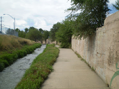
This is the original trail head. I like to ride this route. The trail is right next to the stream.

The trail has been closed for @ 18 months and it's starting to grow over.
That's normal water level, maybe a bit high. Not much safety margin.
This section of path is going to be realigned when the light rail goes through Lakewood Gulch.
Here you can see the three main features in Lakewood Gulch. The Associated Railroad on the right, the stream in the middle and the bike path on the left.
When I moved here in 1997 the Platte River Trolley used to come all the way up here from the Forney Transportation Museum.
Today, the Forney Museum has relocated, R.E.I. has moved in to their former location and a Trolley Association has taken over maintenance and operation of the Trolley. It still runs along the Platte but no more trips up Lakewood Gulch. Just as well, the tracks you see there are going to be the route of the new light rail line to Golden. We'll see some light rail construction farther up the trail.
Lakewood Gulch has it all. Cool water features, lush grass and nice parks.

 The new light rail line is going to be right by the bike path in a few places.
I'm not sure if they're going to use the existing trestle or build something new. Freight trains used this spur once a week or so through the 1980's.
Quiet backyard corridors are going to be bustling with activity soon.
At around 2.3 miles the trail splits. To the left is Martinez Park & Dry Gulch, to the right is Lakewood Gulch Park & trail.
Here's a quick tour up Dry Gulch... 
Modern concrete bike paths with red rumble strips for inattentive bikers.
 The trail leaves Dry Gulch at this bridge. The Dry Gulch cutoff is less than a mile long, but it's a good side track.
This bridge heads South. If you head North about 4 blocks you'd find the Lakewood Gulch but I chose to ride back to where I'd left the main trail.
Look at the tree on the far bank. Man that tree's living the dream, unlimited water. Instead of a dirt bank on the creek it's all wood for 10' each way..
Same with the tree on this side.
OK, now we're back in Lakewood Gulch. Now we see the construction of the RTD West Corridor Light Rail to Golden. They're using the Associated Railroad's right of way.
They knocked down a trestle here. If you look on the left you can see stacked timbers from the earlier rail line.
The light rail line will run here, the bike path will be relocated. Two tracks in this section.
Here's a trestle from the olden days. Looks like it might survive.
The Lakewood Gulch Trail ends at Sheridan Boulevard but I rode further on this side road.
The future light rail tracks are on the other side of the gulch.
Here's a stretch along 13th Avenue West that will soon be a high speed rail line.
Here's looking West at the new light rail construction area.
Denver area voters approved RTD Fast Tracks light rail a few years ago. We taxed ourselves to build out our light rail system.
That just goes to show how intelligent Colorado voters are. As the cost of fuel rises rail transportation will become more popular. 
Future high speed rail corridor. It will be fun to watch the progress of the light rail project.
That's about it, the bike path ended at Sheridan. Lakewood Gulch is a short but fun ride.
I give this ride 3 stars out of 4.
I'm going to see if I can head up Lakewood Gulch, over to Weir Gulch and back down to the Platte to make a longer round trip ride. More on that later...


1 comment:
I'm with the Center for Transit-Oriented Development and I would like to use one of your images from this blog post in a report on the West Corridor light rail improvements. Who should I credit?
I can be reached at jhughes at reconnectingamerica.org
Thanks.
Post a Comment