I took another ride around Chatfield Reservoir to look again at what we would lose if the plan to raise the water level goes through.
I took the light rail South to the Mineral Station.
Then over the bridge over Santa Fe.
Go downhill to the Platte River Trail. There is a 7-11, last chance to get snacks and air for your tires if necessary.
When you reach the Platte River Trail turn left towards Chatfield State Park.
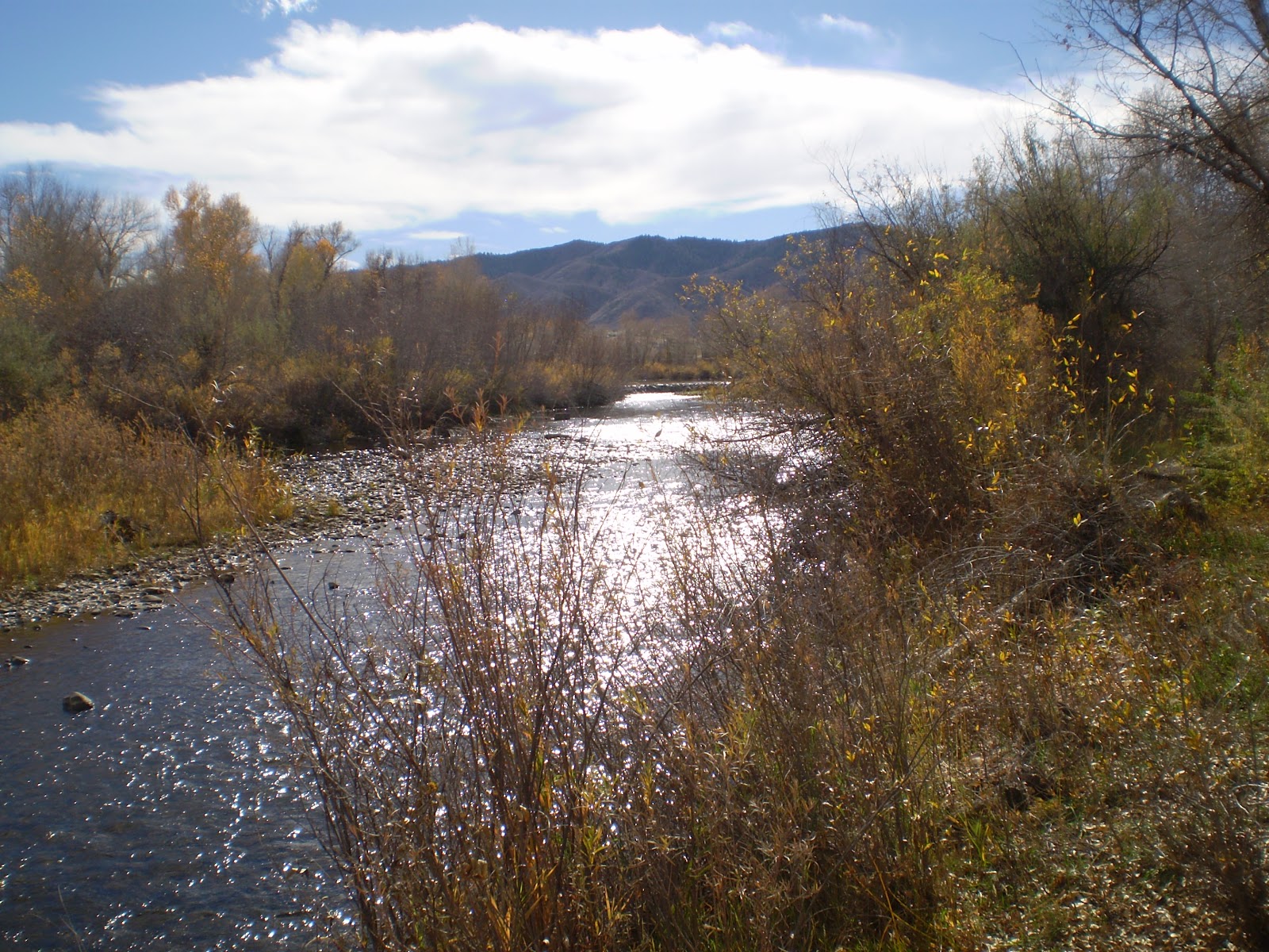
The leaves have turned, Autumn is a beautiful time.
Here we enter the park. Cars have to pay, bikes do not.
Cross the Platte and follow the trail to the right.
The plan this time was to go over the top so I could go up the Platte to Waterton. The top of the dam is closed due to construction so I rode around the long (and scenic) way.
The Army Corps Of Engineers is working on the dam. Unrelated to the expansion plans.
There is a bike path through here but the road was uncrowded so I took it to the Swim Beach.
At the West end of the swim beach parking lot there is my favorite lakeside path. Just past the geese.
Ohh, there's a new Coyote sign on this path. It wasn't here last time.
Cruising through the Cottonwoods.
At the West end of the lake. I don't want my path to get flooded. The woods will die and the animal population will be displaced. Bad humans. Bad!
It's such a nice ride along the shore.
Especially this time of year. Autumn is never long enough.
Winding along through the meadow. This would all get flooded.
Eventually the single track reaches a parking lot. You can see a horse trailer in the distance.
I saw an interesting scat deposit. Coyote probably.
Here's a flash enhanced view. What's that critter eating?

Here's that parking lot, we're almost to the "other" Platte River Trail, the one above the reservoir.
There's a couple horses. I saw several groups of horses and two bikes today. That's more than usual.
After the parking lot you'll see this bridge over the Platte. Turn right just before the bridge.
There it is. It starts out as an asphalt trail.
It's a really nice secluded ride.
Here is one of several groups of horses I encountered. Bikes yield to horses and pedestrians.
Now we are entering beaver country. See the dam?
That is some sweet single track through the leaves.
The Platte River is wild and scenic out this way.
Beaver dams abound.
Beaver cut trees aplenty.
Viva La Beaver! Don't take away their habitat. Habitat is the key to wildlife.
Beaver dams create wetlands which support whole ecosystems. Humans have already caused enough trouble.
These beavers have been busy.
More beaver dams along the Platte.
There's a bird nest out on a limb.
Leaves on a beaver pond.
That hump of sticks is the beavers lodge. When everything is cold and frozen the beaver family will be snug and warm.
Here's another view.
Another pond with tree debris. Don't destroy this habitat.
This is a most excellent trail. It would be a shame to lose it.
OK, eventually you leave the park. Last time I stopped here. This time I'm going exploring up the unknown.
The borderline on the river.
Aside from the transmission towers it's very scenic and secluded.
At one point the trail closed in and my legs got scratched up. I found a better route. More about that later.
I found a secluded bridge built 14 years ago as a scouting project.
Here's the details.
It's held up well although the rope railings have disintegrated.
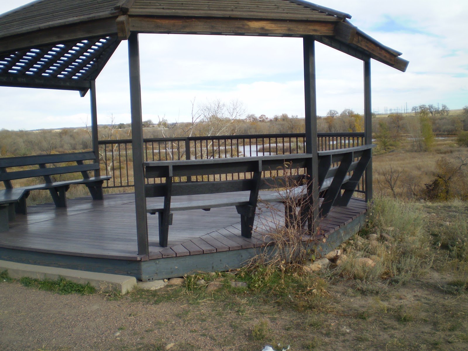
After the bridge the trail got rough and soon I came to Wadsworth Blvd and the entrance to Waterton Canyon. Also located at Wadsworth and the Platte River is the beginning of the Highline Canal Trail, the Grand Daddy trail in the Denver area. I meant to explore the Highline today but the trip up this new trail brought more questions. All along the way there were locked gates leading to I knew not where, but after I found the following structure I could see this is going to take one or two more rides to properly explore and document. The property on the other side of the locked gates were Chatfield Park and there are nature trails in there.I figured that out by studying the map on this sign.
I've seen all the critters depicted on this sign in this park before.
This gazebo looks out over the wetlands, the area I just rode up.
So from the gazebo this dirt trail leads back to the trail I came up. It intersects near the hidden lake.
This hidden lake. Then you ride back to the road we turned off of just before the bridge.
There it is. To complete the circumference of the lake turn right to the dam. I wanted to check out this trail after it crosses the road and heads towards the lake. I always see some wildlife down there.
And today was no different. I saw a small herd of deer, here's a few pictures.
Then it was back on the trail heading towards the camp grounds.
Bird viewing area. Won't be any good if expansion plan goes through.
There is the dam on the horizon.
The bluffs on this end of the lake will keep this area as is.
Now we're in the camping area near the dam.
OK, I knew there were Bears here but the Cougar sign is new. I've never seen either of these in Chatfield but I have seen Cougars at Elway's Cherry Creek.
Find the red path in the campground and head towards the dam.
Chatfield Park is such a pleasant ride. Not very crowded either. I saw two bikers today. Both on the single track.
Cross this bridge then climb the dam.
At the top you'll find train tracks and the dam itself.
I rode along the top of the dam until I was near the construction zone, then I walked my bike down the face of the dam to the road.
Along the top of the dam I took some pics of the threatened Cottonwood forest.
Then it was back up the Platte River Trail to the Light Rail station at Mineral and back home.
This ride answered some questions but posed several more. A couple more Chatfield trips are in order. As I'm discovering more hidden areas I'm more intrigued than ever.
More to follow. FOUR STARS


1 comment:
Like you I tend to ride the paths around Chatfield a lot. I hate to think what the new plan is going to bring. In some ways it just makes me think that more water is going to continue the extremely high growth of the Denver metro area that we have seen in the past 2 decades. I am with you - I will mourn if it actually happens. Jerry Kromer
http://adadandhisboy.blogspot.com
Post a Comment