Click the "Trip Planner" button and you can plan a trip from anywhere.
Here's a shot looking West towards Federal on Clear Creek Trail.
We're headed East so it's a parting shot..
I took this Ride on Sunday August 17 about 10 hours after the region had received heavy rain for two days.
The Clear Creek Drainage got 4" of rain in 48 hours.
It was running high, but nothing like Sand Creek as we will soon see.
This is the Clear Creek Trail / Little Dry Creek Trail junction.
All that mud indicates a flood situation. Little Dry Creek came up through that tunnel.
The dam at the Lower Clear Creek Canal diversion is overflowing big time.
Here's how it usually looks.

This is from March 2008. No water in winter.
This is Twin Lakes Park, you can see the Lower Clear Creek Canal in the foreground.
There is some single track here & there along Clear Creek.
Here we are at the confluence. See Clear Creek empty into the Platte. 
Confluence Park is a great place for a picnic.
Here's another shot of Clear Creek meeting the Platte. This is from the other side of the Platte River .
.
In the mile between Clear Creek and Sand Creek we pass the construction zone. Here's how it looked in April 2008:
Here it is now, all patched up. Denver Water was putting in plumbing to two new reservoirs along the Platte.
OK, here we are at the Sand Creek confluence. Take the bridge over the Platte..
Sand Creek looking mighty turbid today. I've never seen Sand Creek running so high.
A lot of the Sand Creek Trail is dirt. I find it keeps the spandex speedsters away.
Here's a bridge over the Burlington Ditch. The bridge is for cars, not part of the bike path but I thought it looked quaint.
This is the bike bridge over the Burlington Ditch.
This is where Burlington Ditch goes underneath Sand Creek. You can see the far side before it goes underground and then it's bubbling up in the foreground.
Yes, actual white water rapids on Sand Creek. 
Here's what Sand Creek usually looks like. Those rocks in the distance are the cause of the white water above.
Sand Creek runoff August 17 2008.
The concrete portions of the Sand Creek Trail are very nice. Although you're riding through an industrial zone now, the trail also passes through some of the most natural scenery in the metro area further along.
US Highway 6 bridge. Kinda spooky.
Now we're getting back to nature.
Now we come to a Wetland Park. This is really nice and features picnic shelters.
A stop sign before you re-enter the Sand Creek Trail. This far out in the country I think a Yield sign would be more appropriate. 
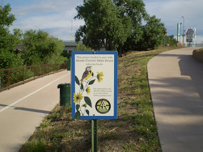
This is a new section of trail. Thank you Adams County!
Then you enter Denver.
 This is the under Quebec Street Bridge over Sand Creek. The city paints over the graffitti regularly. I hope they save this one. I used my zoom, that painting is 15 feet high.
I thought it was awesome and I watched them work for a while. I saw the completed work a week later when I rode that trail again. The next week it was gone, painted over. I was sad it was gone.
 I missed 'em.
I had better luck 2 minutes later when a coyote crossed my path and stopped at the top of a hill to pose for a picture. I took two, this is the best.
 So in 3 minutes I saw a pair of deer and a coyote on the Sand Creek Trail.
  Then I saw a snake.
And a bunny. Lots of Bunnies.

I left it in the middle of the path just as it was.


2 comments:
Great story. I'm planning that ride tomorrow and just happened on to your blog. Your documentation is so terrific. I hope you do more trails like this. We need this. Thanks for all your great work.
cjw
Thanks for the post. I guess I'll have to check out the clear creek trail this weekend.
Post a Comment