Today we're riding Lower Cherry Creek, from the Dam to the Platte River confluence.
Here's a picture as the trail rejoins Cherry Creek just below the dam.
Notice the futuristic RTD lightrail car. The short train runs from Nine Mile to Lincoln.
Just this side of I-225 there are some baseball fields. Next to those are a couple of tree friends I like to visit. Progress strikes again. If you look at the first picture you can see a fence erected with construction happening on the other side.
Just this side of I-225 there are some baseball fields. Next to those are a couple of tree friends I like to visit. Progress strikes again. If you look at the first picture you can see a fence erected with construction happening on the other side.
I could only visit one tree because of the fence. Both trees look healthy though so I'm sure they'll be fine.

There were few if any trees in Denver when it was settled. That means every tree you see in the city has been planted and cared for by someone.
I got a free tree for my yard as part of an effort by the city to plant one million trees. I picked it up and planted it in my front yard on Saturday April 19th. It's a Turkish Filbert.

If you live in Denver you may be eligible check out http://www.theparkpeople.org/ for free or reduced cost trees for next years give away. It's a great program.
OK, after the tree visit the trail continues down, steep and curvy sometimes. Cherry Creek goes through a golf course and the trail descends from the ballfields to Havana to reconnect with the creek after South Havana Street.
Here's the top of the trail


Here's the bottom of the twisty trail where it meets Cherry Creek again.
The trail goes under South Havana Street.
Then you hit the flatlands.
The trail winds along for about a mile then you come upon the Cherry Creek - Highline Canal trail junction.
Here's a map, somewhat outdated. It shows Sand Creek but not the Sand Creek Trail which is 7 years old. Still a good map though.

There's a nice park area where Cherry Creek meets the Highline Canal, here's a picture showing two waterfalls...
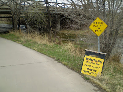
A sure sign of Spring: high water. Didn't see any on this ride but with the warm weather comes runoff.

Still not quite in Denver yet...
 Cherry creek is pretty tame in this picture. Notice the waterfall is designed for high Springtime runoff. Sometime this Spring Cherry Creek will overflow it's banks. There's a lot of snow in the mountains. Some of it's gonna flow right through here.
After you enter Denver Cherry Creek winds along in a park like setting.


The ride is pretty nice. Denver has an excellent park system.
Cherry Creek flows along on a Spring day.
Yes there is still some singletrack along Cherry Creek. Once you pass the Cherry Creek Mall it's all concrete.
25% of the sales tax collected by the city of Denver comes from the Cherry Creek Mall.
See the snow falling in this picture?
The Cherry Creek Trail continues, underneath University Avenue...
It's been "under construction" for months now. What they did was widen the path to eliminate a blind curve that used to be there.
Here's a pictorial featuring the new University underpass.
The new section will be safer because of increased visibility. It's also the last time you see Cherry Creek for a mile or so.
The creek passes through the Denver Country Club while the bike path follows Speer Avenue for a bit before entering the concrete canyons of Denver.
Not that concrete canyons are bad, you can forget you're traveling through downtown.
At the Cherry Creek - Platte River confluence there is a park. Swimming and kayaking fun found here...

That's it for Cherry Creek! Here's a couple pictures of Confluence Park.


No comments:
Post a Comment